CATANIA
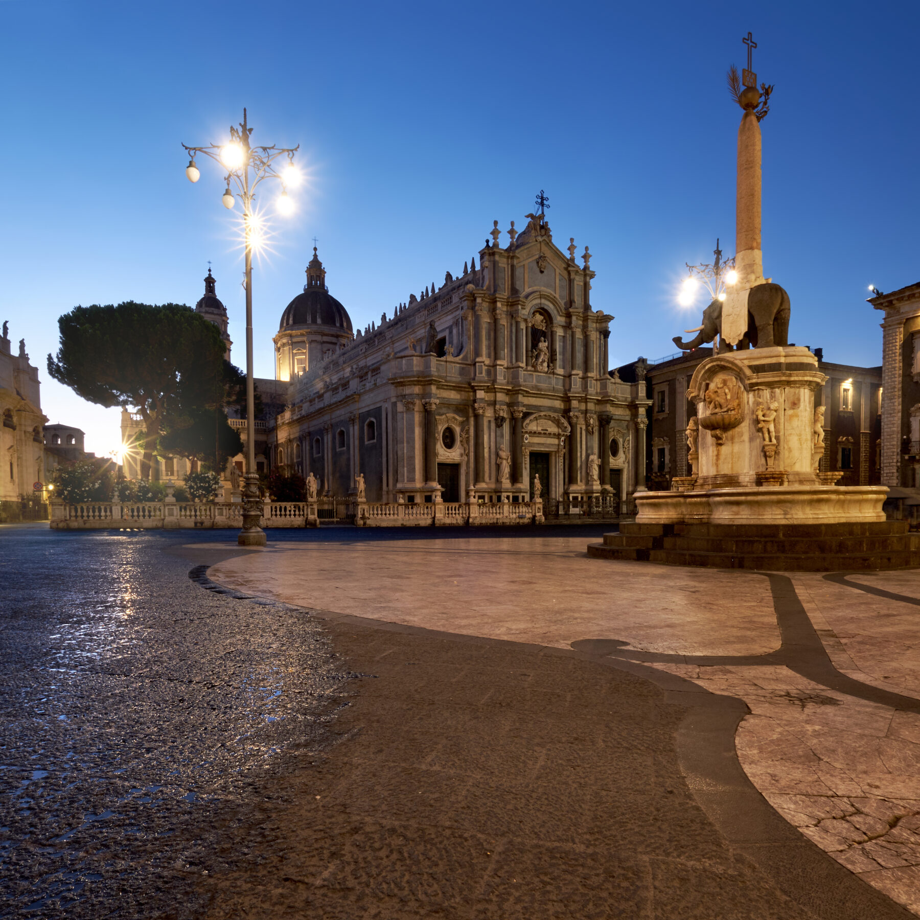 Catania is Sicily’s second-largest city, with a population of around 400,000. It’s the capital of the province founded during the Greek period. The urban landscape is grey and black, because the town is founded on the slopes of the volcano Etna emerged millions years ago from submarine eruptions exactly in this area of the Ionian Sea. In 1669 Catania was covered in lava and then, just 24 years later in 1693, an earthquake shook the town down to its foundations. Thus the entire old part was rebuilt in Baroque style, with large wide-open squares and avenues. Visiting Catania is quite easy, as the old town centre is relatively small, from the port you cross the imposing fortification walls erected between the 16th and 17th century till the arch of Porta Uzeda. You will be impressed by the wide outlook of Piazza Duomo.
The Cathedral, dedicated to St. Agata, the city’s patron saint, stands on the site of an 11th Century church that was almost entirely destroyed in the 1693 eruption. Its replacement is a very impressive, imposing Baroque structure that incorporates some Roman columns taken from the amphitheatre. In the centre of the Duomo square stands the city’s symbol, a lava elephant fountain carrying an obelisk. It bears an enigmatic inscription, MSSHDEPL, which according to some is an acronym for “The mind of St. Agata is sane and spontaneous, honouring God and liberating the city”. Once here a must do is to immerse you into Catania’s colourful, bustling and odorous fish market. Get here before lunch and you will enter a different world, an atmosphere that has remained virtually unchanged for hundreds of years.
If you don’t get lost in the hullabaloo of the market and head southwest, you will come to Piazza Federico di Svevia and the old fortress of Castello Ursino. This imposing structure was built by Frederick II of Hohenstaufen in the 13th century on a rocky cliff overlooking the sea. However, the massive lava spill of the 1669 eruption pushed the sea back, creating in one fail swoop a new coastline and stripping Castello Ursino of its strategic position.
Moving back northwards you will come across a rather different aspect of the city: its ancient origins. Catania was founded in the 8th Century BC by Greeks from Chalcis. It subsequently became a Roman city and amazingly, considering the dramatic series of volcanic eruptions and earthquakes that have so afflicted the area, three theatres have survived from this period. The Teatro Romano, in Via Vittorio Emanuele, next door is the Odeon, a smaller theatre used for more intimate occasions, such as musical performances, and the amphitheatre, found in Piazza Stesicoro at the crossroads of Via Etnea and Corso Sicilia, considered the largest amphitheatre in Sicily, said to accommodate around 15,000 spectators.
The main street Via Etnea is full of shops in between Baroque palaces and churches. Mind to have an aperitivo in this open air elegant scenery and if you want to live the local life head to Bar Savia for the best arancini and cannoli.
We suggest to explore Catania after boarding for an evening walk after sunset and enjoy dinner in one of the local restaurants or in the motning with a guided tour of the historical center and a street food lunch in the fish marke
ACITREZZA AND ACICASTELLO
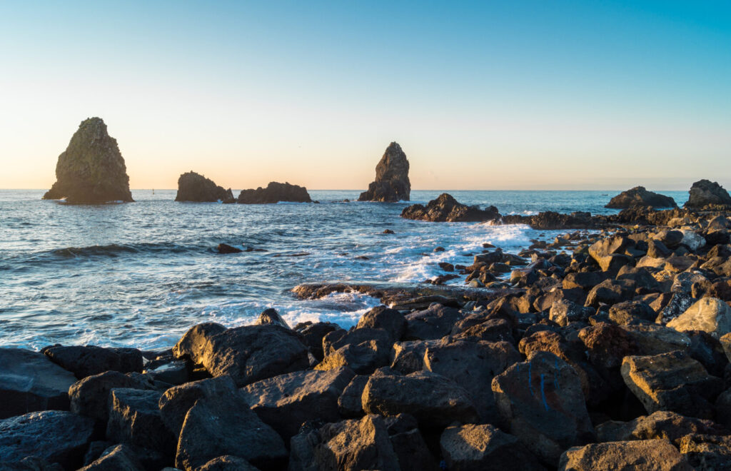 From the harbour of Catania you can navigate to Acicastello. The name originates from the Norman Castle that stands on the sea, totally carved on lava stone which offers a wonderful view of the coast. At the foot of the castle there is an elegant little square, with a splendid view of the cliff and stacks of Aci Trezza, which lie on the opposite side of the bay. Aci Trezza (‘A Trizza in Sicilian) is a fishing village famous for its landscape. Officially founded at the end of the seventeenth century by Stefano Riggio that made it an important maritime port and the center of the local business life with numerous stores adapted to contain oil, iron, meats and cheeses. The panorama is dominated by the huge rocks called Faraglioni of the Cyclops: eight picturesque basaltic rocks that, according to the legend, were launched by Polifemo to Ulysses during his escape. Not far from the coast (400 m away), is present the Lachea Island, identified with the Homeric Goats’ Island. The bay is protected by the Marine Park of i Faraglioni di Acitrezza, created in the late 20th century to protect the endemic flora and fauna of the submarine coastline which present a gorgeous vegetation and some beautiful fish specimen.
This is the village in which Giovanni Verga set his famous novel “I Malavoglia” (1881) and in which, in 1948, was shot the movie inspired to it “La terra trema” by Luchino Visconti and Antonio Pietrangeli, masterpiece of Neorealism made with the inhabitants of the village themselves.
You can enjoy a short navigation in the morning around this spot and enjoy lunch in one of the local restaurants, then return to Catania for overnight before to start navigating south direction.
BRUCOLI
 Navigating from Catania you approach to this enchanting small village by the Arcile: a bay overlooking the Gulf of Catania which has a steep coastline and a beach formed by pebbles of various sizes. Very popular is the “Rock of the turtle” name due to the particular shape that recalls the physiognomy of the animal. Brucoli was born next to a natural channel. To the west of the canal are the remains of a village dating back to the neolitich period. Many remains are concentrated in a sort of limestone board called “Gisira“, rich in inlets, caves and hermitages. You cannot miss a swimming in this brilliant transparent waters and enjoy lunch in charming trattoria by the water before to continue your navigation to Syracuse.
SYRACUSE
 Syracuse, the city of the first Greek colonisation in Sicily with a rich history, culture and architectural patrimony, nonetheless it is the birthplace of the pre-eminent mathematician and engineer Archimedes.
This 2,700-year-old city played a key role in ancient times, when it was one of the major powers of the Mediterranean world. Located in a drastic rise of land with 2,000 metres (6,600 ft) depths being close to the city offshore although the city itself is generally not so hilly in comparison.
The city was founded by Ancient Greek Corinthians and Teneans and became a very powerful city-state, allied with Sparta and Corinth and exerted influence over the entirety of Magna Graecia, of which it was the most important city. Later became part of the Roman Republic and the Byzantine Empire. Under Emperor Constans II, it served as the capital of the Byzantine Empire (663–669).

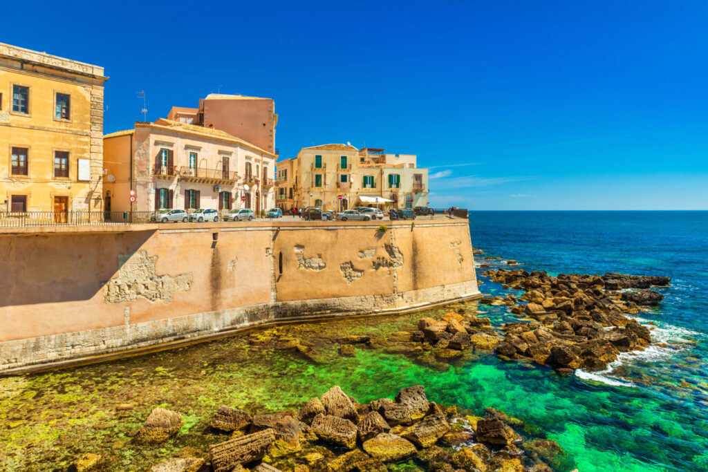
Listed by UNESCO as a World Heritage Site along with the Necropolis of Pantalica. The population is around 135,000 people. The patron saint of the city is Saint Lucy; she was born in Syracuse and her feast day, Saint Lucy’s Day, is celebrated on 13 December. It was shattered by an earthquake in 1693 and owes some of the finest Baroque architecture noticeable in the sumptuous palaces and churches located in Ortigia. The Allied invasion of Sicily in 1943 during World War II caused Syracuse some damage that was swiftly repaired in a new and greater postwar prosperity. The city is now a centre for processing local agricultural produce and has several other light industries. The harbour, with its commerce and fishery, and tourism are further sources of income. Syracuse’s nucleus is formed by the southward-projecting island of Ortygia, which half-encloses the bay known as the Great Harbour.
Then we have the archaeological remains in Neapolis: the Greek theatre of Hieron II (3rd century BCE), a Roman amphitheatre (2nd century CE), and an altar of Hieron II, pillaged in 1526 to provide building materials for defensive walls. The nymphaeum (fountain) above the theatre was one of the ancient city’s sources of water. Among the most imposing remains of ancient Syracuse are the fortifications of the Epipolae Plateau, which culminate in the Euryalus fort at their western end.
The cathedral on Ortygia, with a fine Baroque facade, incorporates the Doric columns of the temple of Athena that was built as a thanks offering by the Syracusans for their victory at Himera. The re
mains of the Temple of Apollo (c. 565 BCE) stand near the bridge from Ortygia to the mainland. The streets of Ortygia bear witness to the medieval and Renaissance contributions to the charm of Syracuse.
From the harbour you can immerse you in a walking tour around baroque and greek style, small shops, boutique and cafes till the wide Piazza Duomo where many film maker, such as Giuseppe Tornatore took the most beautiful film scene, which gave to the public a dreamy view of this special location displaying the full Sicilian culture from ancient time till nowadays. Don’t miss to enjoy an aperitivo at sunset moored in the large harbour bay, when the sun rays illuminate all the yellow coloured buildings in a surreal atmosphere to fallen in love with. We suggest to spend 2 nights in this area to explore the city, enjoy a cooking class with street market walk and mind to have a guided tour of Noto another Unesco site very important in Baroque scenery of the 17th century in Italy, it’s a drive of less than 40 minutes to enjoy in the late afternoon to avoid high temperatures.
VENDICARI AND MARZAMEMI
 The Vendicari Nature Reserve was planned by a law of the Region of Sicily in 1981, but it was officially established in 1984. The history of the reserve has very ancient origins since the Greek era.
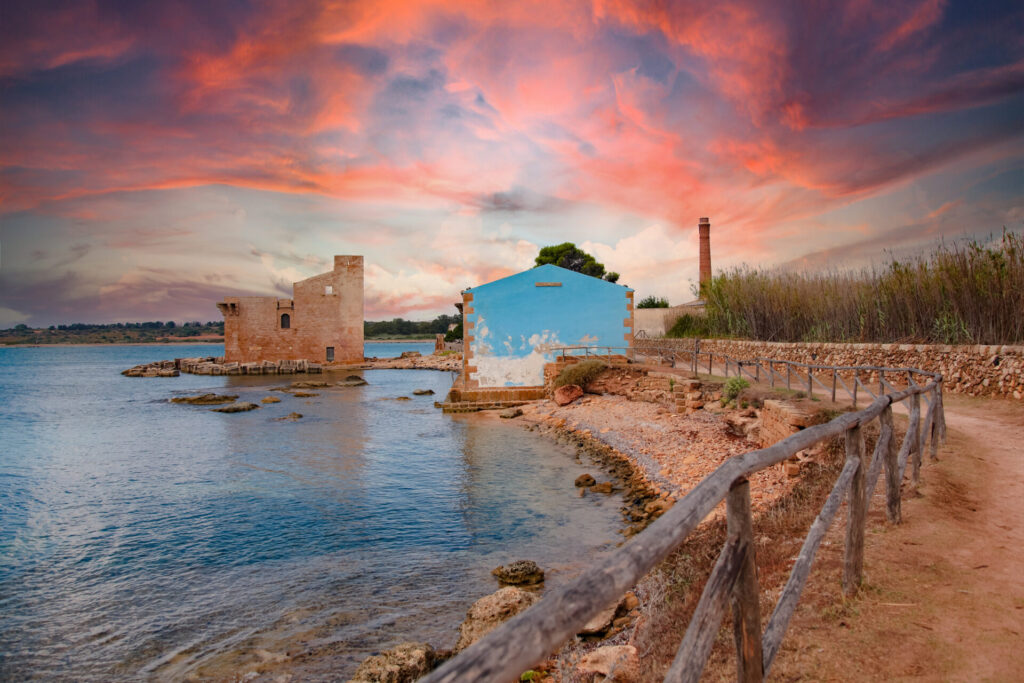
From the beach Marianelli, there are some quarries (stone quarries) of the 5th century BC used for the construction of temples and monuments. By the sea there are tanks for tuna processing, next to which a small necropolis was also discovered. Inside the reserve, even a portion of the ancient via Elorina is visible, the connecting road between the colony of Eloro and Syracuse. During the medieval ages raised the construction which mostly characterize the reserve when you arrive by the sea: The Sveva Tower, probably built by Peter of Aragon, count of Albuquerque and duke of Noto (1406-1438).

This fortification was required to report and repel attacks of Saracen pirates and Barbary, which with their constant raids systematically ransacked the inhabited centres and countryside of the island. During the centuries, the structure was reinforced and rebuilt, until it took the current form. The Sveva Tower was used until the 19th century, time of invention of the telegraph that made obsolete these defence systems.
The reserve is also a marine protected area, mooring is forbidden we must stay almost at 800mt from the shore, but with calm sea it is possible to stop for a swimming around this stunning territory.
From Vendicari we approach to the fishermen village of Marzamemi.
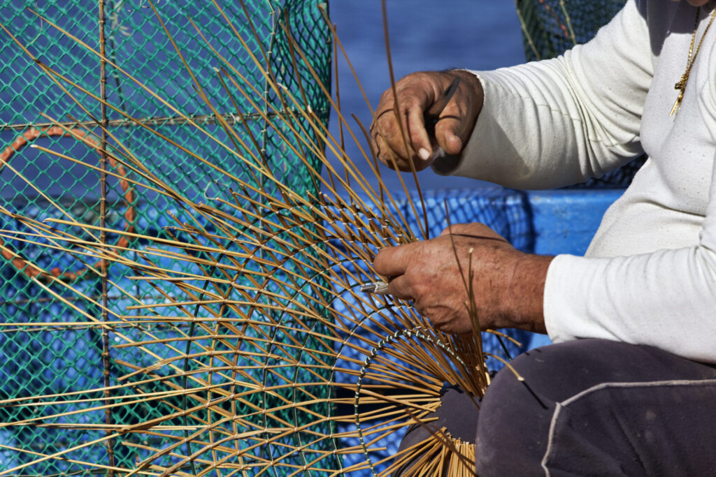
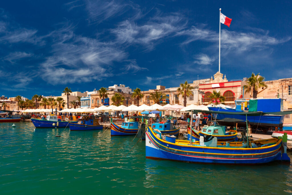
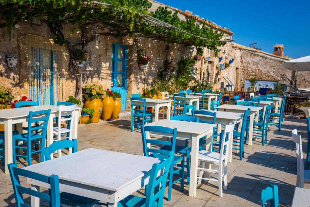 Founded during the arab period, the name, Mars- al-hamam which means as something like Turtle Dove Bay. The original tonnara (tuna processing plant), become one of the most important on the island. Although the tonnara itself is no longer in function, Marzamemi continues its artisanal fishing and processing activities, producing all manner of delicacies, including canned tuna, dried tuna roe (bottarga), smoked swordfish, marinated anchovies, seafood pasta condiments, tuna salamis and much more besides! The old centre of the village, most of which dates back to the arrival of the Principe di Villadorata in the mid-18th century, is situated on a little promontory and organised around the extremely picturesque Piazza Regina Margherita. On the south side is the little fishing harbour with its bobbing fleet of colourful wooden boats, on the others a series of charming buildings, including the Church of San Francesco di Paola, the tonnara, the prince’s aristocratic palazzo and a row of fishermen’s houses, whose sky blue doors and potted red geraniums lend a chromatic vivacity to the whole picture. Narrow streets lead off the main square, offering glimpses of the turquoise sea to the east and north.

Marzamemi hosts in July an International Film Festival during which films are projected directly on the walls of the buildings surrounding the piazza. The fresh nocturnal atmosphere will delight you between open-air bars, sipping on sundowners and cooling down after a day’s sunbathing and swimming. Then it’s off to one of the excellent seafront fish restaurants, such as La Cialoma. As night falls, the piazza is taken over by live bands and DJs who provide entertainment for anyone in a dancing mood. We suggest to spend the afternoon in this charming corner of paradise at sunset and live a indigeneous nightlife betwen locals and visitors dancing in the square under the moonlight.
PORTOPALO DI CAPO PASSERO AND ISOLA DELLE CORRENTI
 From Marzamemi we approach to one of the cap of the island, the extreme edge of Sicily to Africa
Portopalo di Capo Passero is the furtherst strip of coast in the south of Sicily, the last mainland outpost between the sea and the sky to the south of the Tunis parallel. This strip of coast alternates long beaches with sandy dunes and sheer cliffs.

The island of Capopassero is 1300 meter long and 500 meter wide nature reserve extending for 37 hectares. The Ionian and the Mediterrenean seas lap its shores. Judging it a natural treasure, the Italian Botanical Society included the island in its list of most botanically fascinating Sicilian biotypes for the abundant presence of dwarf palmettos, sea lilies and sea rocket. The entire island is a nature reserve, also because the loggerhead sea turtle (Caretta Caretta) has returned to lay her eggs along this coast. The island has a high and steep seashore profile to the east and a sandy shoreline to the west, where the combined action of tides and winds over the years has created a gorgeous beach. The small island is dominated by a lighthouse and hosts the remains of a defensive tower from the XIV century. It is the most southern point of the European continent, joined to Sicily by a very narrow isthmus, sometimes covered by the sea. An explosion of colours occurs in springtime, when heathers, rock roses, lentisks and gramineous plants start to blossom. Opposite l’Isola delle Correnti the coast is extremely shallow with very broad and beautiful beaches, among which are the beaches of “Carratois” and “Punta delle Formiche”.You can enjoy swimming in this particular nature wonder and enjoy a light lunch on board, then head to the last part of your cruise the island of Malta.
MALTA
Malta is a country in the European Union and considered part of Southern Europe. The capital of Malta is Valletta with around 500,000 habitants. The territory is 316 sq km, which makes it one of the smallest countries. The country comprises five islands—Malta (the largest), Gozo, Comino, and the uninhabited islets of Kemmunett (Comminotto) and Filfla-lying some 58 miles (93 km) south of Sicily, 180 miles (290 km) north of Libya, and about 180 miles (290 km) east of Tunisia, at the eastern end of the constricted portion of the Mediterranean Sea separating Italy from the African coast. Maltese is the national language and is influenced by Greek due to Magna Grecia settlements in Sicily. Maltese and English are the official languages in line with the constitution of the country. A majority of the people of Malta can speak three languages; Maltese, English and Italian.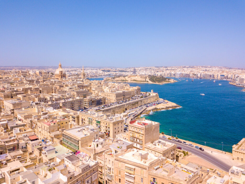 People have lived in Malta since at least 5200 BC. The island has some key archaeological sites dating from early times. Malta became well known as the base of the Knights Hospitaller. They moved to Malta after being forced to leave Palestine and then Rhodes, in Greece. In 1565 they survived a great attack by the Ottoman Empire. The history of the knights at Malta continued the strong Roman Catholic beliefs in the country that were started by the Norman and Spanish rulers. In 1798, Napoleon took control of Malta. The French rule was not popular and in 1800 Maltese rebels invited the British Royal Navy to come to the island. This led to 200 years as a British colony and independent Commonwealth member. During World War II, Malta was attacked this time by the Axis forces. The entire island was symbolically given the George Cross for heroism. Malta became independent in 1964 and a republic in 1974. In 2004 Malta joined the European Union and in 2008 Malta joined the Euro.
 Maltese architecture has been influenced by many different Mediterranean cultures and British architecture. The Roman period introduced highly decorative mosaic floors, marble colonnades, and classical statuary, remnants of which are beautifully preserved and presented in the Roman Domus, a country villa just outside the walls of Mdina. The early Christian frescoes that decorate the catacombs beneath Malta reveal a propensity for eastern, Byzantine tastes. These tastes continued to inform the endeavours of medieval Maltese artists, but they were increasingly influenced by the Romanesque and Southern Gothic movements. The islands of Malta are dominated by limestone formations, and much of their coastlines consist of steep or vertical limestone cliffs indented by bays, inlets, and coves. They lie on the submerged Malta-Hyblean Platform. The highest areas are coralline limestone uplands that constitute a triangular plateau; Ta’ Żuta, which rises to 830 feet (253 metres) in the southwest, is the highest point. The uplands are separated from the surrounding areas by blue clay slopes, while an undercliff area is found where the coralline plateau has fallen and forms a subordinate surface between the sea and the original shore. The total shoreline of Malta is about 136 miles (219 km).
Once here you have many opportunities to visit this fantastic territory from daily navigation with awesome cricks and bays to swim and have fun to cultural sightseeing on mainland and the outstanding nightlife with its numerous casinos and restaurants, shops, discotheques and bars.